Embed Size (px)
Citation preview
8/8/2019 WS#2 Presentation (Draft 9-30-10)
http://slidepdf.com/reader/full/ws2-presentation-draft-9-30-10 1/37
Public Workshop #2Public Workshop #2Octob er 20 10
8/8/2019 WS#2 Presentation (Draft 9-30-10)
http://slidepdf.com/reader/full/ws2-presentation-draft-9-30-10 2/37
2
Meeting AgendaMeeting Agenda
1. Background
2. Corridor Design 101
3. Opportunities and Constraints
4. Workshop

8/8/2019 WS#2 Presentation (Draft 9-30-10)
http://slidepdf.com/reader/full/ws2-presentation-draft-9-30-10 3/37
Project BackgroundProject Background
YouTube Video
8/8/2019 WS#2 Presentation (Draft 9-30-10)
http://slidepdf.com/reader/full/ws2-presentation-draft-9-30-10 4/37
Draft Purpose StatementDraft Purpose Statement
The pu r pose o f t h i s p r o j ect i s t o…
Address corridor congestion and safety problems.
Serve future north-south traffic.Serve expected population growth in the area.
– Damascus,
– Happy Valley,– Pleasant Valley Plan Area and
– Gresham,
Serve the growing demand for regional travel.
8/8/2019 WS#2 Presentation (Draft 9-30-10)
http://slidepdf.com/reader/full/ws2-presentation-draft-9-30-10 5/37
Project Goals & ObjectivesProject Goals & Objectives
Cor r ido r A l ign m en t Goa ls
1. Improve mobility for:
– Through traffic– Local community,
– Freight movement.
2. Minimize impacts to:
– Environmental resources,
– Cultural resources, and
– Social
3. Provide flexibility for:– Changing socio-economic conditions,
– Development opportunities.

8/8/2019 WS#2 Presentation (Draft 9-30-10)
http://slidepdf.com/reader/full/ws2-presentation-draft-9-30-10 6/37
Goals & Objectives (cont.)Goals & Objectives (cont.)
St r eet scape Goals
4. Provide a unique, aesthetically pleasing design thatpreserves rural character.
5. Integrate “green streets” design with the natural features.
6. Improve safety for all users.
7. Support healthy and walkable communities.
8/8/2019 WS#2 Presentation (Draft 9-30-10)
http://slidepdf.com/reader/full/ws2-presentation-draft-9-30-10 7/37
Goals & Objectives (cont.)Goals & Objectives (cont.)
Land Use & Transpor t a t i on I n t eg r a t i on Goal s
8. Protect the long-term function of the corridor.
9. Ensure that the corridor plan supports local economicdevelopment.
I m p lem en t at i on Go al s
10. Ensure effective project implementation by selecting aplan that is fundable and can be built in phases.
8/8/2019 WS#2 Presentation (Draft 9-30-10)
http://slidepdf.com/reader/full/ws2-presentation-draft-9-30-10 8/37
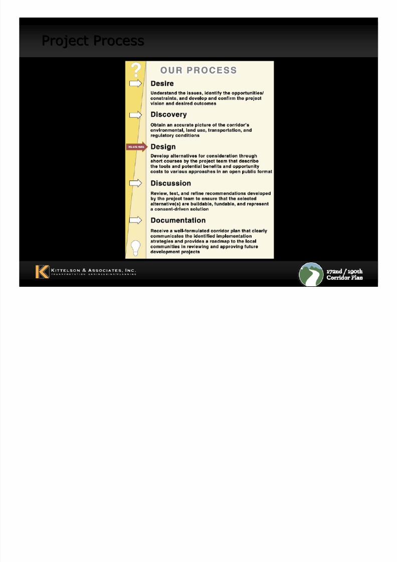
Project ProcessProject Process
8/8/2019 WS#2 Presentation (Draft 9-30-10)
http://slidepdf.com/reader/full/ws2-presentation-draft-9-30-10 9/37
9
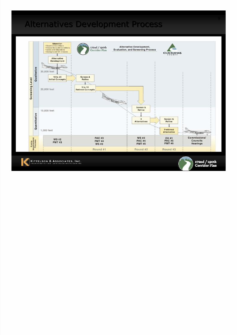
Alternatives Development ProcessAlternatives Development Process
8/8/2019 WS#2 Presentation (Draft 9-30-10)
http://slidepdf.com/reader/full/ws2-presentation-draft-9-30-10 10/37
10
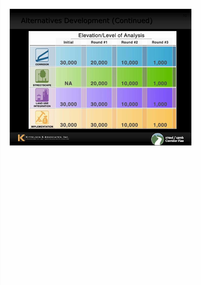
Alternatives Development (Continued)Alternatives Development (Continued)

8/8/2019 WS#2 Presentation (Draft 9-30-10)
http://slidepdf.com/reader/full/ws2-presentation-draft-9-30-10 11/37
Corridor Design 101Corridor Design 101
Roadw ay Des ign Bas ics:
Horizontal Alignment
Vertical Alignment
Roadway Cross Sections
Intersection Treatments
Intersection Spacing
8/8/2019 WS#2 Presentation (Draft 9-30-10)
http://slidepdf.com/reader/full/ws2-presentation-draft-9-30-10 12/37
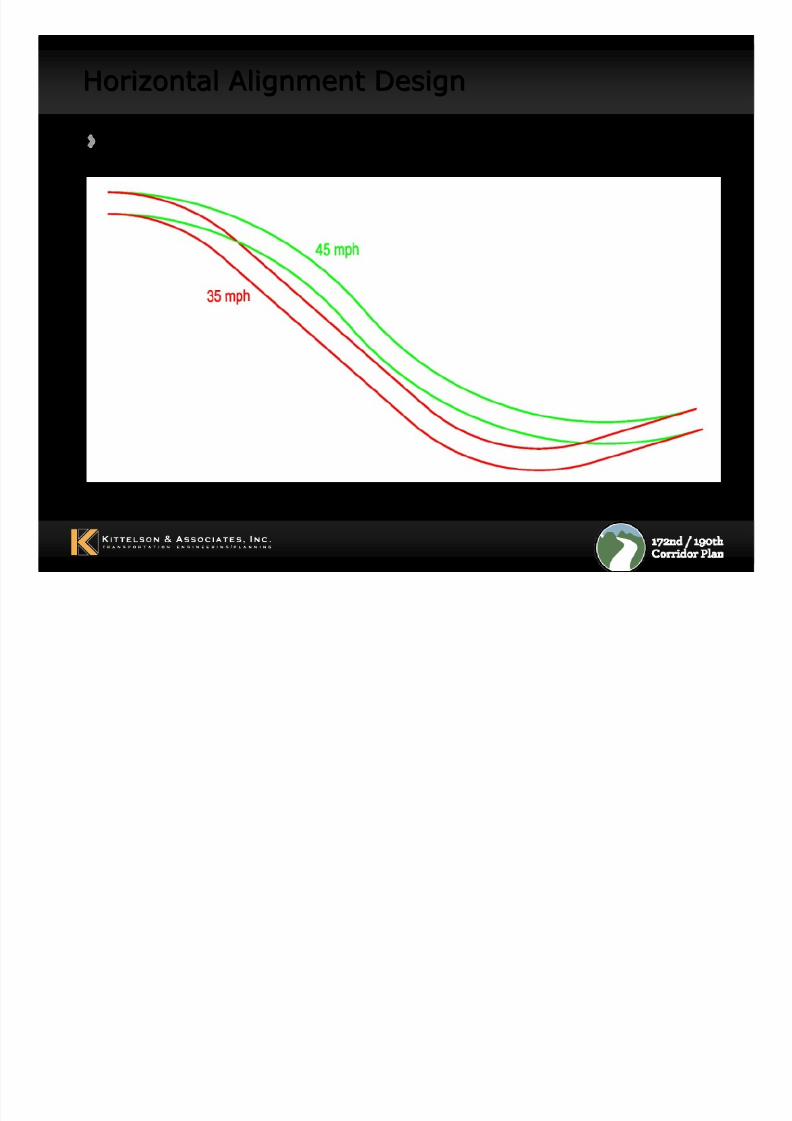
Horizontal Alignment DesignHorizontal Alignment Design
Maximum degree of curve based on speed
8/8/2019 WS#2 Presentation (Draft 9-30-10)
http://slidepdf.com/reader/full/ws2-presentation-draft-9-30-10 13/37
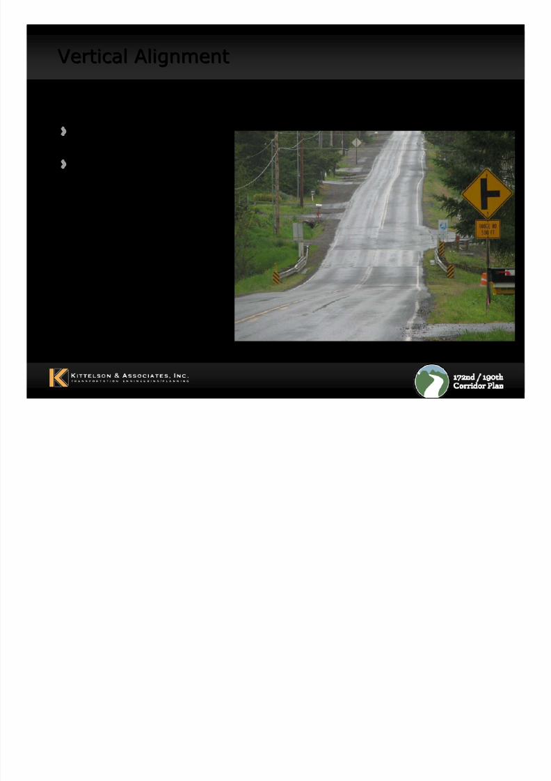
Vertical AlignmentVertical Alignment
Maximum Roadway Grades:
8% for arterials,
12% for collector/local roadways
8/8/2019 WS#2 Presentation (Draft 9-30-10)
http://slidepdf.com/reader/full/ws2-presentation-draft-9-30-10 14/37
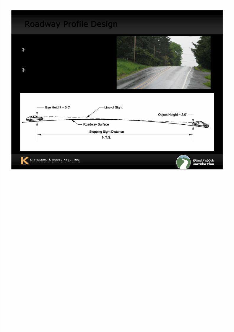
Roadway Profile DesignRoadway Profile Design
Sight distancerequirements
Vertical curve design
8/8/2019 WS#2 Presentation (Draft 9-30-10)
http://slidepdf.com/reader/full/ws2-presentation-draft-9-30-10 15/37
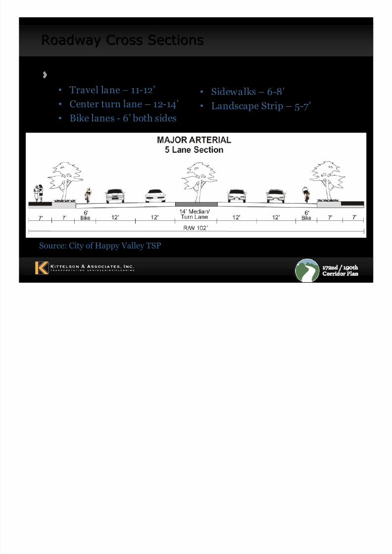
Roadway Cross SectionsRoadway Cross Sections
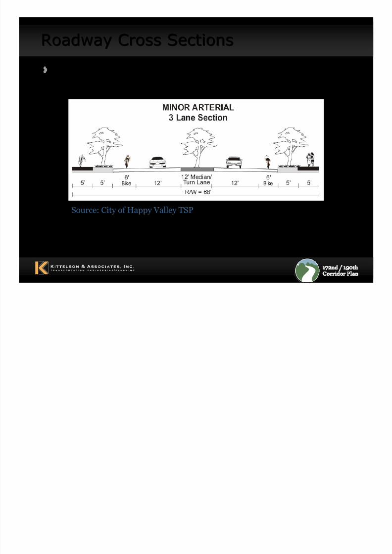
Design lane width requirements• Travel lane – 11-12’
• Center turn lane – 12-14’• Bike lanes - 6’ both sides
• Sidewalks – 6-8’
• Landscape Strip – 5-7’
Source: City of Happy Valley TSP
8/8/2019 WS#2 Presentation (Draft 9-30-10)
http://slidepdf.com/reader/full/ws2-presentation-draft-9-30-10 16/37
Roadway Cross SectionsRoadway Cross Sections
Source: City of Happy Valley TSP
Typical 3-Lane Arterial
8/8/2019 WS#2 Presentation (Draft 9-30-10)
http://slidepdf.com/reader/full/ws2-presentation-draft-9-30-10 17/37
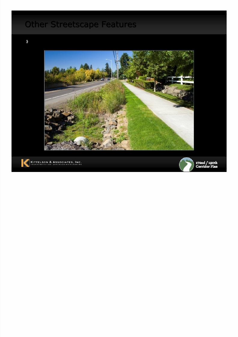
Other Streetscape FeaturesOther Streetscape Features
Drainage Considerations
8/8/2019 WS#2 Presentation (Draft 9-30-10)
http://slidepdf.com/reader/full/ws2-presentation-draft-9-30-10 18/37
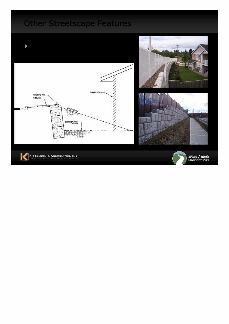
Other Streetscape FeaturesOther Streetscape Features
Retaining wall to minimizeimpacts
8/8/2019 WS#2 Presentation (Draft 9-30-10)
http://slidepdf.com/reader/full/ws2-presentation-draft-9-30-10 19/37
Example Cross SectionsExample Cross Sections
Photos to be added
– 172nd Ave (south)
– Sunnyside Rd
– Kruse Way – Others…
8/8/2019 WS#2 Presentation (Draft 9-30-10)
http://slidepdf.com/reader/full/ws2-presentation-draft-9-30-10 20/37
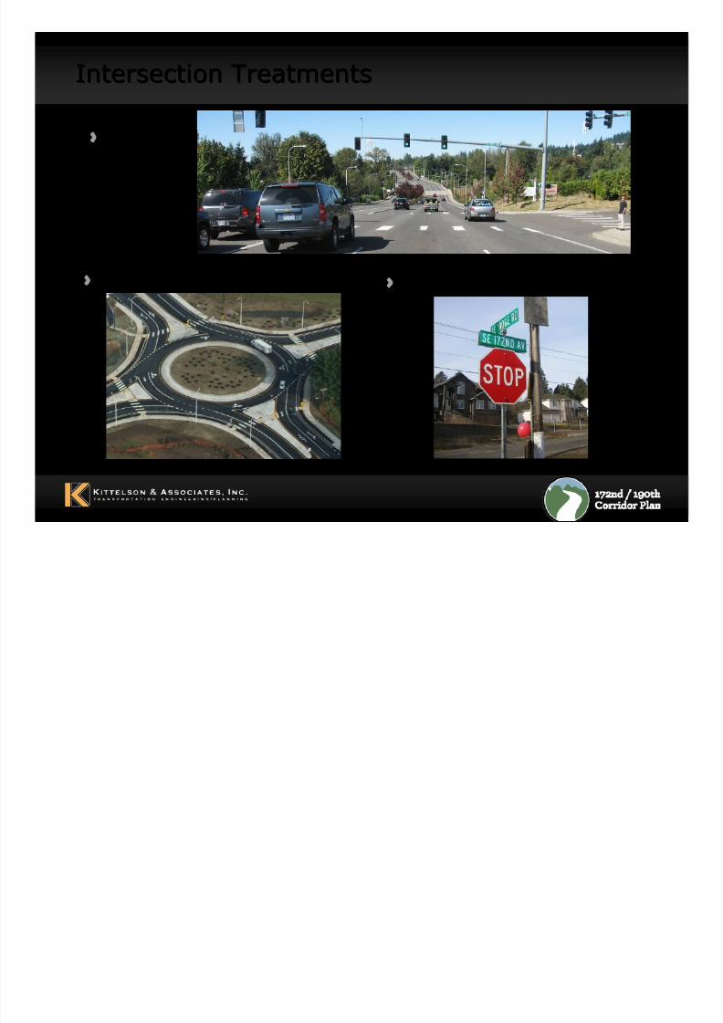
Intersection TreatmentsIntersection Treatments
Roundabouts
TrafficSignals
Stop Sign Control
8/8/2019 WS#2 Presentation (Draft 9-30-10)
http://slidepdf.com/reader/full/ws2-presentation-draft-9-30-10 21/37
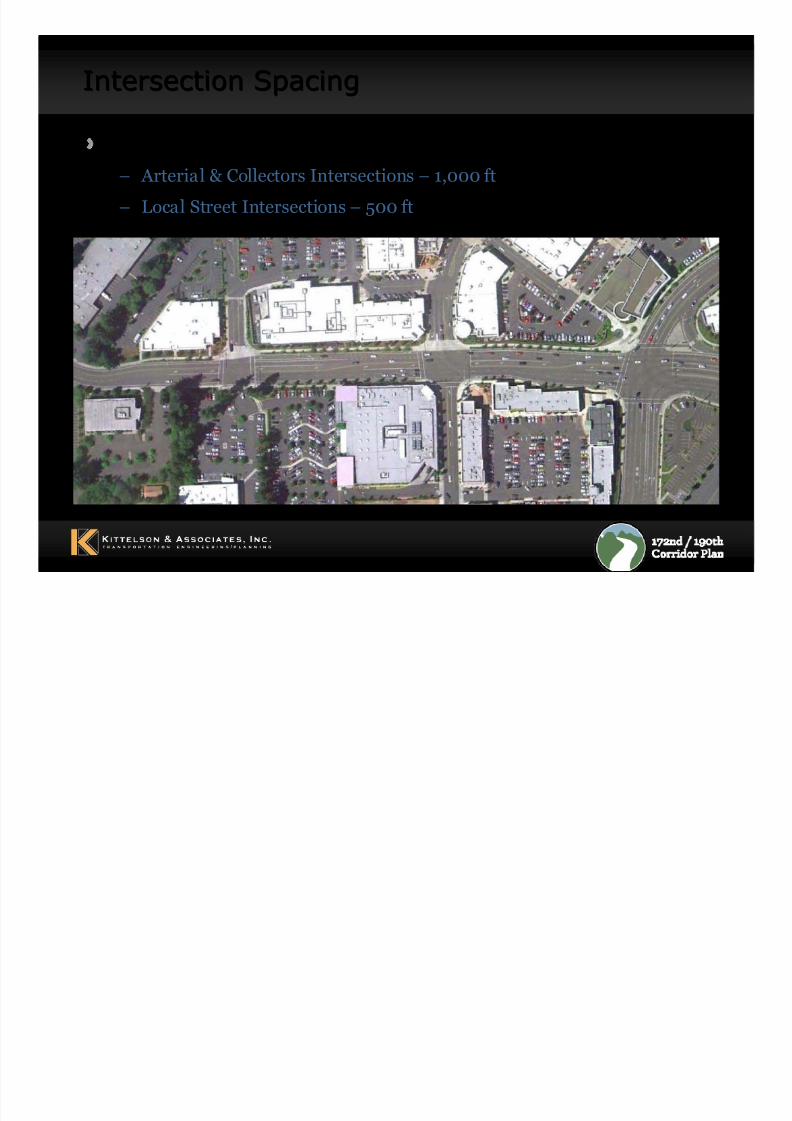
Intersection SpacingIntersection Spacing
Minimum Intersection Spacing
– Arterial & Collectors Intersections – 1,000 ft
– Local Street Intersections – 500 ft
8/8/2019 WS#2 Presentation (Draft 9-30-10)
http://slidepdf.com/reader/full/ws2-presentation-draft-9-30-10 22/37
Opportunities and ConstraintsOpportunities and Constraints
Stakeholder Interviews
Existing Conditions
Projected Future Conditions
Other Planned Transportation Improvements
8/8/2019 WS#2 Presentation (Draft 9-30-10)
http://slidepdf.com/reader/full/ws2-presentation-draft-9-30-10 23/37
23
Stakeholder Interview SummaryStakeholder Interview Summary
Key t hem es:
Respect Property Rights
Preserve Rural Character
Reduce Congestion
Improve Safety
8/8/2019 WS#2 Presentation (Draft 9-30-10)
http://slidepdf.com/reader/full/ws2-presentation-draft-9-30-10 24/37
24
Existing Conditions Analysis Completed:Existing Conditions Analysis Completed:
Existing Transportation Conditions
Future Transportation Conditions
InfrastructureNatural Resources
Historical and Cultural Resources
Hazardous Materials
Socio Economic and Land Use
8/8/2019 WS#2 Presentation (Draft 9-30-10)
http://slidepdf.com/reader/full/ws2-presentation-draft-9-30-10 25/37
25
Existing Transportation Conditions AnalysisExisting Transportation Conditions Analysis
Current traffic volumes:
– 172nd Avenue: 8,500 vehicles per day (Near Hemrick Rd)
– Foster Road : 7,500 vehicles per day (Near Cheldelin Rd)
– SE Sunnyside Road: 9,000 vehicles per day (Near 172nd Ave)
All study intersections operate acceptably except
Foster Road/172nd Avenue (LOS F)
Intersection crash rates are within normal levels
No bike or sidewalk facilities
8/8/2019 WS#2 Presentation (Draft 9-30-10)
http://slidepdf.com/reader/full/ws2-presentation-draft-9-30-10 26/37
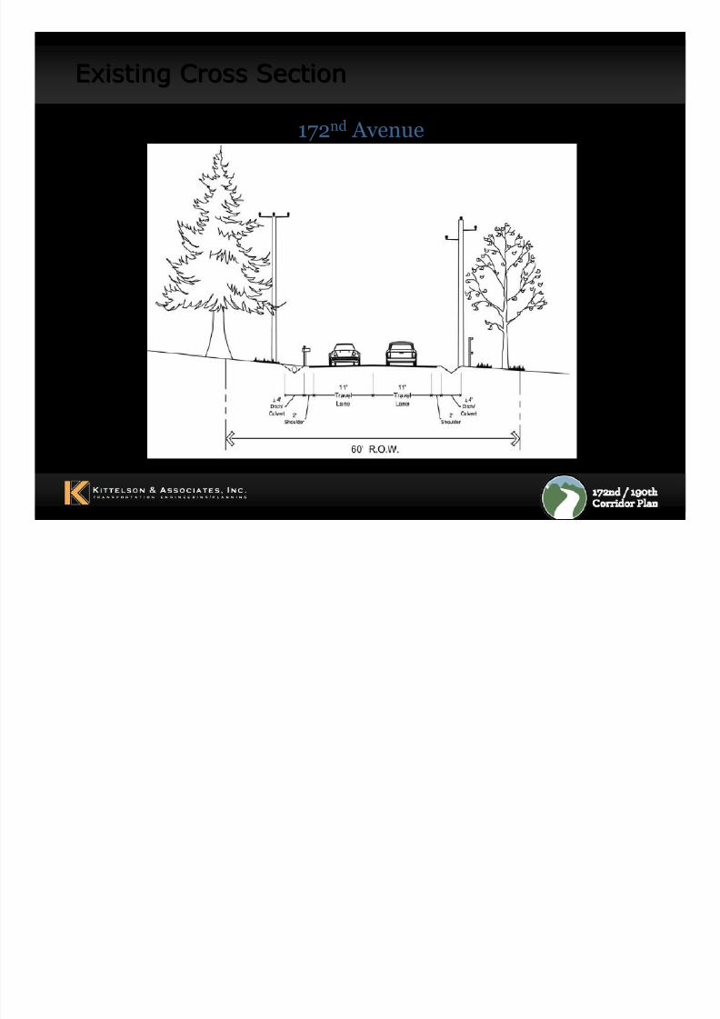
Existing Cross SectionExisting Cross Section
172nd Avenue
8/8/2019 WS#2 Presentation (Draft 9-30-10)
http://slidepdf.com/reader/full/ws2-presentation-draft-9-30-10 27/37
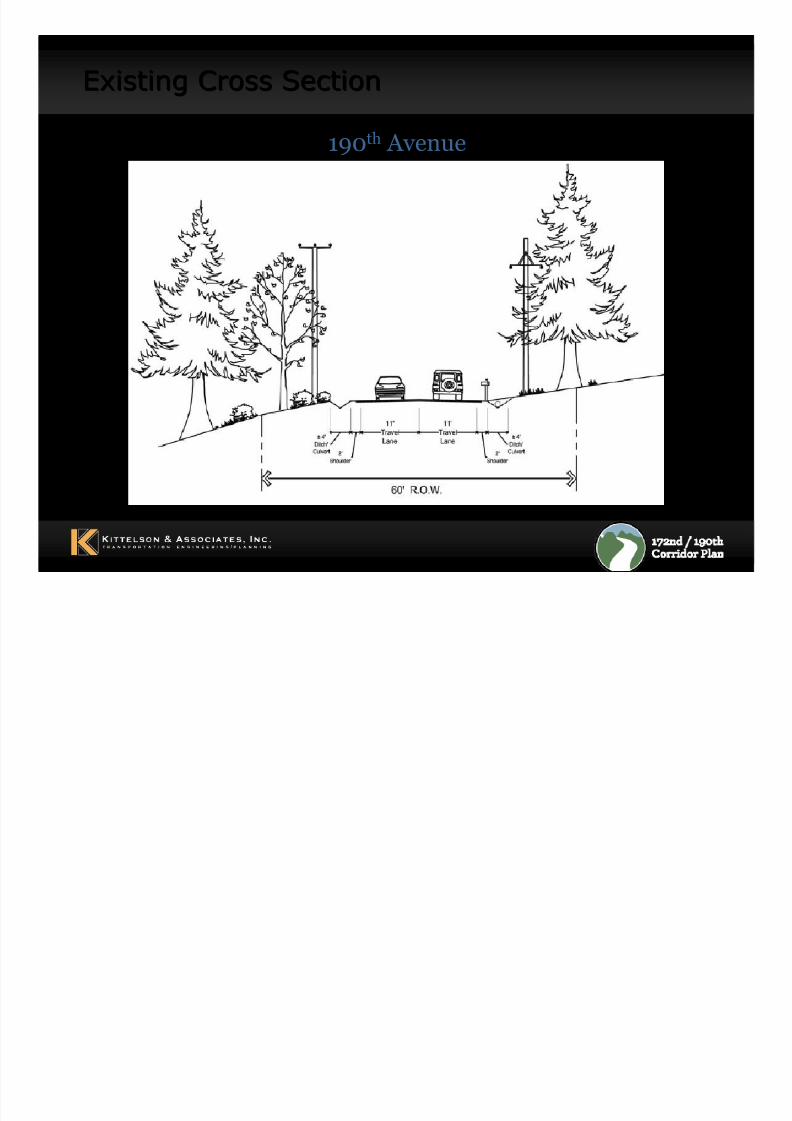
Existing Cross SectionExisting Cross Section
190th Avenue
8/8/2019 WS#2 Presentation (Draft 9-30-10)
http://slidepdf.com/reader/full/ws2-presentation-draft-9-30-10 28/37
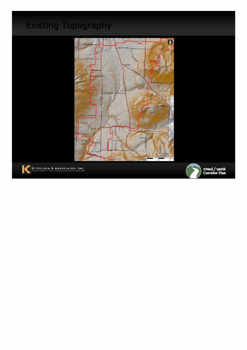
Existing TopographyExisting Topography
8/8/2019 WS#2 Presentation (Draft 9-30-10)
http://slidepdf.com/reader/full/ws2-presentation-draft-9-30-10 29/37
29
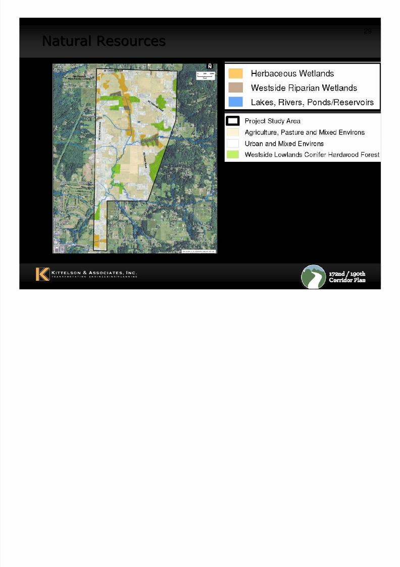
Natural ResourcesNatural Resources

8/8/2019 WS#2 Presentation (Draft 9-30-10)
http://slidepdf.com/reader/full/ws2-presentation-draft-9-30-10 30/37
30
Historical and Cultural ResourcesHistorical and Cultural Resources
10 historical resources within the PSA eligible for NationalRegister of Historic Places
– Generally located along Foster Rd
No archaeological sites have been recorded within the PSA
The PSA has a low to moderate likelihood of containing
archaeological sites
8/8/2019 WS#2 Presentation (Draft 9-30-10)
http://slidepdf.com/reader/full/ws2-presentation-draft-9-30-10 31/37
31
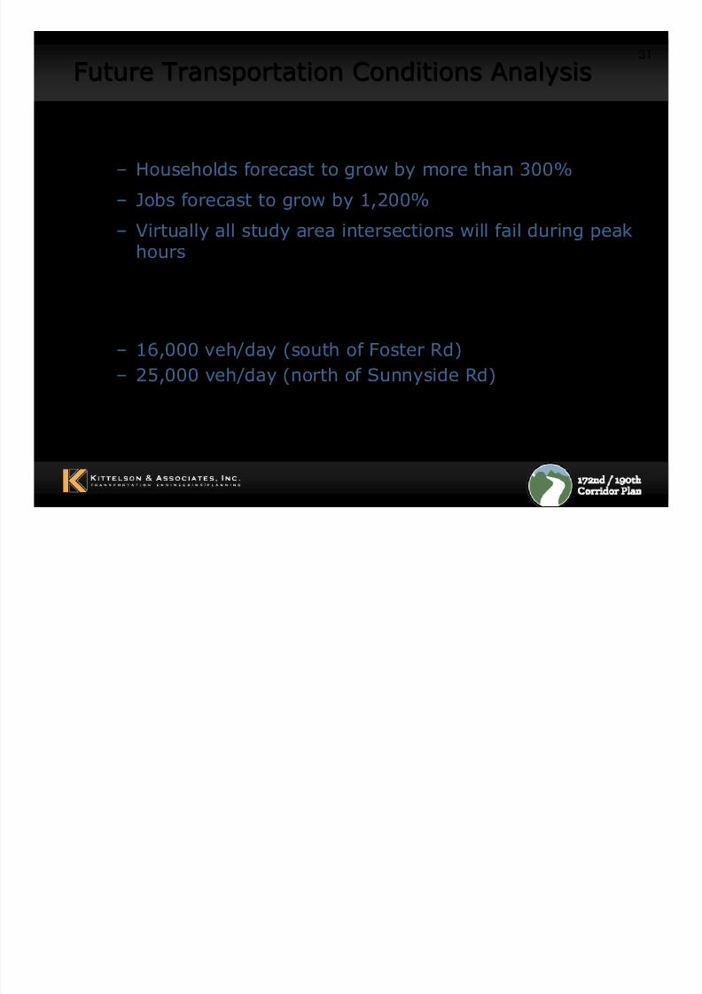
Future Transportation Conditions AnalysisFuture Transportation Conditions Analysis
2035 Projections in Project Study Area:
– Households forecast to grow by more than 300%
– Jobs forecast to grow by 1,200%
– Virtually all study area intersections will fail during peakhours
2035 Projected ADT
– 16,000 veh/day (south of Foster Rd)
– 25,000 veh/day (north of Sunnyside Rd)
8/8/2019 WS#2 Presentation (Draft 9-30-10)
http://slidepdf.com/reader/full/ws2-presentation-draft-9-30-10 32/37
32
Future Transportation Conditions AnalysisFuture Transportation Conditions Analysis
– 172nd and 190th Avenue roadway cross-sectionswill require 3 to 5 lanes:
– 5 Lanes at South End– 3 Lanes at North End
– Ten intersections would require roundabouts or
traffic signals under current road network
8/8/2019 WS#2 Presentation (Draft 9-30-10)
http://slidepdf.com/reader/full/ws2-presentation-draft-9-30-10 33/37
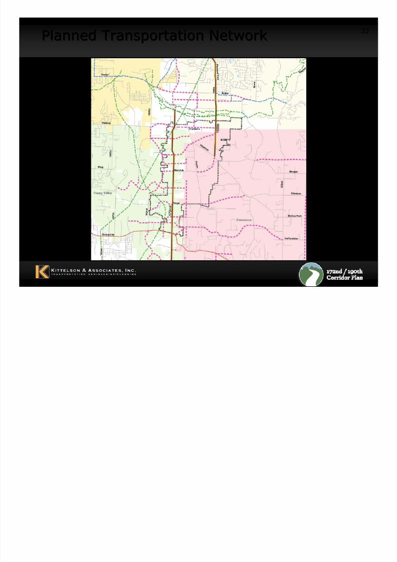
33
Planned Transportation NetworkPlanned Transportation Network
8/8/2019 WS#2 Presentation (Draft 9-30-10)
http://slidepdf.com/reader/full/ws2-presentation-draft-9-30-10 34/37
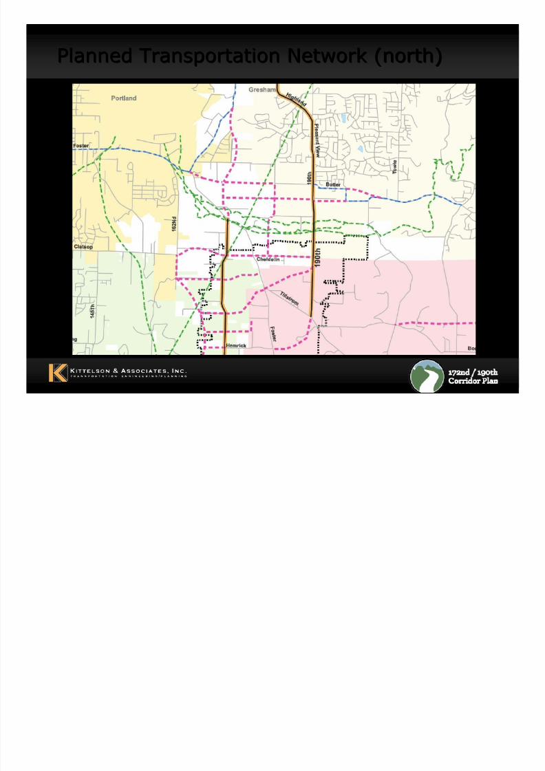
Planned Transportation Network (north)Planned Transportation Network (north)
8/8/2019 WS#2 Presentation (Draft 9-30-10)
http://slidepdf.com/reader/full/ws2-presentation-draft-9-30-10 35/37
8/8/2019 WS#2 Presentation (Draft 9-30-10)
http://slidepdf.com/reader/full/ws2-presentation-draft-9-30-10 36/37
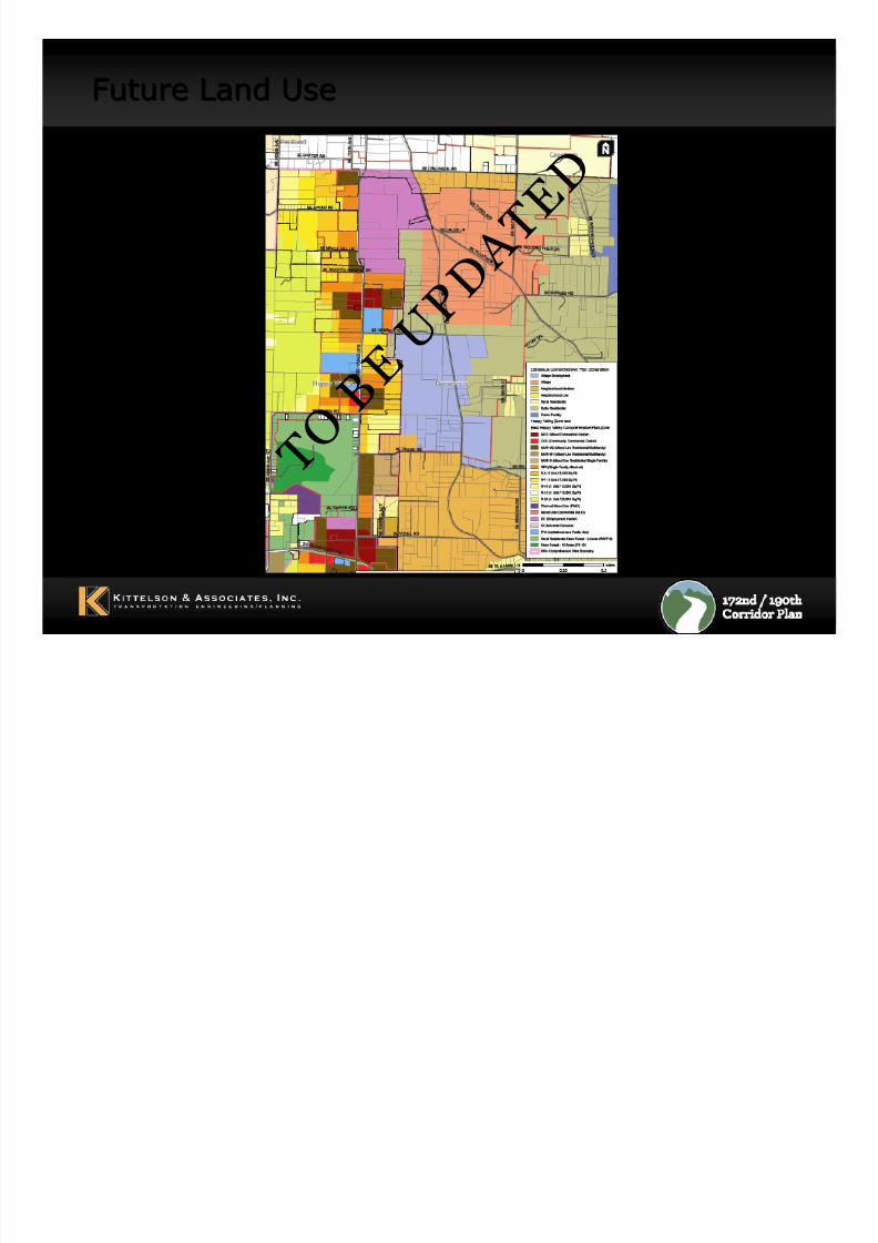
Future Land UseFuture Land Use
T O B E
U P D
A T E
D
8/8/2019 WS#2 Presentation (Draft 9-30-10)
http://slidepdf.com/reader/full/ws2-presentation-draft-9-30-10 37/37
37
Lets Create Some Corridor Design Concepts…Lets Create Some Corridor Design Concepts…
– Add image of design tool and base map